Products
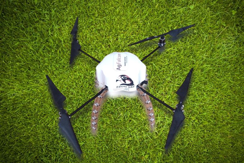
AgFalcon MR4
A precision agriculture UAV (unmanned aerial vehicle) system designed and built for Australia. The AgFalcon hexacopter is a tough ag tool, capable of scanning between 100 to 120 acres of your crop, orchard or vineyard.
With a spectral camera mounted underneath, taking images in the Near InfraRed wavelength; these can be used to create NDVI maps to pinpoint problem areas, or to show those plants that are very healthy and do not need any chemical treatment. Save money.
The AgFalcon is also versatile – carrying a variety of cameras / sensors / even a bird scaring unit. The AgFalcon is ideally suited to operate on smaller areas. Those that are surrounded by trees, hills and can benefit from this drone’s ability to hover.

With on-board high definition video camera option, the AgFalcon can transmit live images back to your laptop; monitor stock movement, set a flight path to observe farm infrastructure, gates, water holes, fence lines. With a flight time of up to half an hour in video mode and having 6 motors for that extra ‘insurance’. The AgFalcon can be your eye-in -the-sky.
Made from advanced carbon fibre composites. Fast local servicing if needed and an auto pilot system that allows for very simple flight operations.
The Facts & Specs
- Coverage: 40 ha / 100 acres in a 25 min flight. Fly 30 mins with lite weight video cam.
- Autonomous flight program; it will fly to the GPS points on your laptop.
- Auto launch and auto land.
- Manual control at any time.
- Electric power, no mess.
- Materials are durable purpose built for the Ag world.
- Optional Digital or Video cameras kits available.
- System comes with NDVI spectral camera and all image processing software.
- Durable Hecta or Quad Copter Flight Controller
- Flight Planning Software
- Auto Pilot Firmware and Software
- Li Po Battery Packs and Smart Fast Charger
- NDVI or RGB modified cameras
- Optional Video kit or Bird Screecher
- Flight Instructions Spare parts kit
- On-site set up and training available
The Ageagles System
- eBee X Fixed Wing
- Flight Planning Software
- Auto Pilot Firmware
- Optional: Image stitching software
- Optional: Farm Management Software
- Li Po Battery Packs and Smart Multi Charger
- NDVI modified camera
- Proprietary Launcher
- Flight Manual Pack
- Flight Instructions
- USB Ground Controller
- Cables and Spares
- On-site training available
- Distributors of the SenseFly and BASK Agricultural drone systems
- SenseFly System
- eBee Aircraft flying wing
- Project Specific Camera
- eMotion Flight Software
- Portable backpack
- Spare Propellers
- Lithium Polymer battery
- Battery Charger
AgEagle RX48
A most economical fixed wing drone solution for precision agriculture. The new RX48 is hand launched is minutes, does not need internet connectivity. Creates flight missions easily and quickly. The Botlink NIRX image processing eliminates issues from cloudy shadows.

AgEagle RX48
- Scan 100 to 120 hectares in a single 30 min flight.
- Create fast crop health maps; identify problems, save money on treatment costs.
- Fully autonomous flight; Android tablet does the flying and landing.
- Flies in windy conditions that would hamper hobby type quad copters.
- True NIR from Sentera NDVI sensor.
- Durable composite construction.
- Weighs less than 2 Kg for non-license requirement.
- We set it up for you, then train you on-site.
The RX48 system includes
- Flying wing
- 6600 mAh Li Po Battery
- Smart Battery Charger
- Flight control software
- Sentera NIR camera
- Optional image processing software or cloud based processing
- On-site training available.


