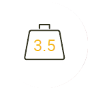
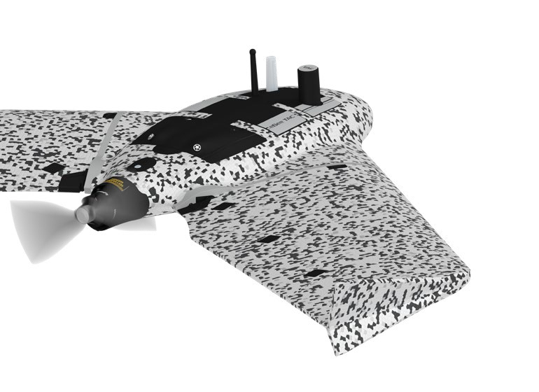
DIGITAL-A4-eBee-TAC

$250.00

Light weight 3.5 lb

Deployment in 3 minutes

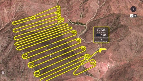
Up to 90 minutes flight time

Up to 1,235 ac mission coverage at 400 ft altitude

Silent radio mission

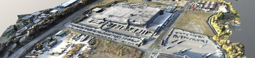
3D modeling, terrain & thermal mapping

High Accuracy Tactical Mapping Solution

eBee TAC operates in disconnected environments to provide a higher-accuracy mobile solution to map and share imagery data on rapidly-shifting environments in order to analyze and act with precision. This is a Swiss made portable solution that can be transported and maintained without requiring external support.

Validated as Cyber-Secure

  • Radio Data Link Encryption AES-256
  • Drone Log File Suppression
  • Silent Radio Mission
  • Data and Communication Control
  • Encrypted SD Card

eMotion Flight Planning Software

Easy-to-use, eMotion helps you get your drone in the air quickly while including all the functionality you need to collect and manage exactly the geospatial data you require.

Data generated

With its mission directed swappable sensor suite, eBee TAC allows you to collect data that can be immediately used via the SD card for analysis and decision making
Fully operational solution with the capability to integrate with situation awareness tools such as ATAK

Specifications

Table Header
Wingspan
45.7 in (116 cm)
Material
Expanded Polypropylene (EPP)
Underbody skin
Curv® Polypropylene thermoplastic composite
Max. take-off weight
3.6 lb (1.6 kg)
Transport case dimension
29.5 x 20 x 13 in (75 x 51 x 33 cm)
Table Header
Motor
Low-noise, brushless, electric
Detachable wing
Yes
Radio link range
1.9 mi (up to 5 mi) 3 km nominal (up to 8 km)
Frequency
2.400 - 2.4835 GHz
Data storage
On-board encrypted SD card

Flight performance

Table Header
Cruise speed
11-30 m/s or 25-68 mph (40-110 km/h)
Max. wind resistance
Up to 12.8 m/s or 28.6 mph (46 km/h)
Landing type
Linear landing with Steep Landing technology (16.4 ft / 5 m accuracy in 35° angle cone)
Service temperature
5° to 104°F (-15° to 40°C) Working above 95 °F / 35°C requires to protect the drone from the sun while on the ground
Humidity
Light rain resistance
Ground avoidance
Yes - LiDAR (range 394 ft / 120 m)
Ground resolution
Down to 0.6 in (1.5 cm)
Max. flight time
90 minutes
Mission coverage at 400 ft / 120 m
543 ac to 1,235 ac (2,2 km² to 5 km²)
Linear coverage
Up to 17.2 mi (27.7 km) out and back
liter

1L, 5L, 20L, 200L, Per L, 1000L, Bulk/1000L

Shopping Cart